
-
Turnkey service
We build, maintain, and monitor the scraper for you -
No technical work required
You simply receive the data, no technical work is required -
Time saving
Perfect for those short on time—just tell us what you need


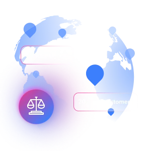
Geospatial dataset
Access all available public data points from Geospatial related websites with datasets built to your specifications. Get clean, structured, and validated data with tailored schemas, flexible delivery, expert support, and seamless integration, all fully managed to power your strategic moves.

- Clean, structured and compliant data
- Ready-to-use insights and analysis
- Custom dashboards, reports and delivery
- Expert consulting & recommendations
Trusted by 20,000+ customers worldwide
Access Geospatial data in just a few clicks
Choose the domain, outline your data requirements, and let our AI scraper builder automatically create the API.
- Describe data needs in plain English
- AI instantly generates the scraper API
- Run API requests for immediate results
- Edit the code in the built-in IDE, if needed
- Schedule runs daily, weekly, or at custom intervals
Tailor your data workflow

Accurate Geospatial data tailored to your needs
Go beyond raw data with a fully managed service that delivers ready-to-use data with structured insights

Hands-off data collection & processing
Eliminate the burden of data collection so your data and engineering teams can focus on high-impact work.

Accurate, reliable, and ready-to-use data
Receive clean, structured data with automated validation and quality checks.

Actionable insights that go beyond raw data
Get dashboards, reports, and expert analysis to turn data into decisions.

Scalable & flexible data solutions
Easily scale from thousands to billions of records, tailored to your needs.

Fully compliant & ethically sourced data
Ensure data collection aligns with website policies and global regulations.

End-to-end data management
From extraction to insights, get a fully managed solution. No infrastructure, development or data processing needed.
DATASET MARKETPLACE
Looking for available datasets?
Chances are we've already built and maintained the data collection from popular websites. Ensure hassle-free data access by using ready-made datasets.
- Demo data in JSON/CSV
- Fresh records
- Customize, enrich, and format the data
LinkedIn people profiles
ID, Name, City, Country code, Position, About, Posts, Current company, and more.
Business
Popular
 117.1K+
 11K+
11K+Amazon products
Title, Seller name, Brand, Description, Initial price, Currency, Availability, Reviews count, and more.
eCommerce
Popular
LinkedIn company information
ID, Name, Country code, Locations, Followers, Employees in linkedin, About, Specialties, and more.
Business
Popular
Instagram - Profiles
Account, Fbid, ID, Followers, Posts count, Is business account, Is professional account, Is verified, and more.
Social media
Crunchbase companies information
Name, URL, ID, Cb rank, Region, About, Industries, Operating status, and more.
Business
Popular
Enriched
Linkedin job listings information
URL, Job posting id, Job title, Company name, Company id, Job location, Job summary, Job seniority level, and more.
Business
Instagram - Posts
URL, User posted, Description, Hashtags, Num comments, Date posted, Likes, Photos, and more.
Social media
Google Maps full information
Place id, URL, Country, Name, Category, Address, Description, Business details, and more.
Business
Zillow properties listing information
Zpid, City, State, HomeStatus, Address, IsListingClaimedByCurrentSignedInUser, IsCurrentSignedInAgentResponsible, Bedrooms, and more.
Real estate
Popular
LinkedIn posts
URL, ID, User id, Use url, Title, Headline, Post text, Date posted, and more.
Social media
X (formerly Twitter) - Posts
ID, User posted, Name, Description, Date posted, Photos, URL, Quoted post, and more.
Social media
TikTok - Profiles
Account id, Nickname, Biography, Awg engagement rate, Comment engagement rate, Like engagement rate, Bio link, Predicted lang, and more.
Social media
Youtube - Videos posts
URL, Title, Youtuber, Youtuber md5, Video url, Video length, Likes, Views, and more.
Social media
Amazon Reviews
URL, Product name, Product rating, Product rating object, Product rating max, Rating, Author name, Asin, and more.
eCommerce
TikTok - Posts
URL, Post id, Description, Create time, Digg count, Share count, Collect count, Comment count, and more.
Social media
Facebook - Pages Posts by Profile URL
URL, Post id, User url, User username raw, Content, Date posted, Hashtags, Num comments, and more.
Social media
Indeed job listings information
Jobid, Company name, Date posted parsed, Job title, Description text, Benefits, Qualifications, Job type, and more.
Business
Companies information enriched dataset
URL, ID lc, Name lc, Country code lc, Locations lc, Followers lc, Employees in linkedin lc, About lc, and more.
Business
Enriched
Shopee - products
URL, ID, Title, Rating, Reviews, Initial price, Final price, Currency, and more.
eCommerce
Walmart - products
URL, Final price, Sku, Currency, Gtin, Specifications, Image urls, Top reviews, and more.
eCommerce
TikTok Shop
URL, Title, Available, Description, Currency, Initial price, Final price, Discount percent, and more.
eCommerce
Employees business enriched dataset
URL, Profile url, Linkedin num id, Avatar, Profile name, Certifications, Profile location, Profile connections, and more.
Business
Enriched
YouTube - Channels
URL, Handle, Handle md5, Banner img, Profile image, Name, Subscribers, Description, and more.
Social media
Reddit- Posts
Post id, URL, User posted, Title, Description, Num comments, Date posted, Community name, and more.
Social media
Glassdoor companies overview information
ID, Company, Ratings overall, Details size, Details founded, Details type, Country code, Company type, and more.
Business
Popular
Enriched
Google maps reviews
URL, Place id, Place name, Country, Address, Review id, Reviewer name, Reviews by reviewer, and more.
Business
Instagram - Reels
URL, User posted, Description, Hashtags, Num comments, Date posted, Likes, Views, and more.
Social media
Airbnb Properties Information
Name, Price, Image, Description, Category, Availability, Discount, Reviews, and more.
Travel
X (formerly Twitter) - Profiles
X id, URL, ID, Profile name, Biography, Is verified, Profile image link, External link, and more.
Social media
IMDB media
Title, Popularity, Genres, Presentation, Credit, Videos, Photos, Top cast, and more.
Free datasets
Pricing Plans
Collect data from Geospatial by turning prompts into ready‑to‑run scrapers with built‑in proxies and automatic unblocking.
We accept these payment methods:
Every plan gives you full access - pay less per record as you scale
Data Collection
- Automated proxy management
- Full browser rendering
- CAPTCHA solving
Performance at Scale
- Unlimited concurrency
- Batch & scheduled collection
- Job management APIs
Data Delivery
- Data validation & discovery
- Data parsing (JSON or CSV)
- Webhook or API delivery
Seamless Geospatial Data Access
Comprehensive, Scalable, and Compliant Geospatial Data Extraction
FLEXIBLE
Enterprise-grade infrastructure
Bright Data’s platform powers over 20,000+ companies worldwide, offering peace of mind with 99.99% uptime, access to 400M+ real user IPs covering 195 countries.

SCALABLE
Advanced data discovery, collection and processing
Get maximum control and flexibility without maintaining proxy and unblocking infrastructure. Easily scrape data from any geo-location while avoiding CAPTCHAs and blocks.
STABLE
Tailored to your workflow
Get structured, validated data with customized delivery and integration options, including tailored reports, dashboards, and analytics, across historical crawls and multiple websites.

COMPLIANT
Industry leading compliance
Our privacy practices comply with data protection laws, including the EU data protection regulatory framework, GDPR, and CCPA – respecting requests to exercise privacy rights and more.
Get structured and reliable Geospatial data
Why 20,000+ Customers Choose Bright Data
100% Compliant
Scraped data is ethically obtained and compliant with all privacy laws.
24/7 Global Support
A dedicated team of data professionals is here to help.
Complete Data Coverage
Access 400 million+ global IPs to scrape data from any website.
Unmatched Data Quality
Advanced technologies and validation methods for quality data.
Powerful Infrastructure
Scrape high-volume data without getting blocked.
Custom Solutions
Get tailored solutions to meet unique needs and goals.
Bright Data is used by world's top brands
We help businesses grow with secure, scalable, flexible data management.
 I recommend using Bright Data’s products for any company, especially in the finance industry. Bright Data is trustworthy and compliant, the service is great, the products are flawless and their network is fast and stable.
 Xiaolong ShiCrawler Engineer at Bitget
- Bright Data has their own proxy infrastructure which helps keep your web data flowing plus, their web unlocker helps beat any pesky CAPTCHAs that might be holding you back.Watch now
 Nicholas RenotteData Science Specialist
  From my experience, Bright Data’s service has been invaluable. Bright Data helped us collect enough public web data to meet our needs, and with its support and development staff, we optimized many of our processes.
 Charmagne CruzHead of Reporting & Analytics, Business Technologies and Pricing at Shopee Philippines Inc.
- Having the best quality and quantity of data is the most important thing, and that’s where the combination of Bright Data and tgndata works.Watch now
 George KoutsoudopoulosCEO at tgndata
 - We are really impressed with the reliability, and very happy with Bright Data overall. We have a regular communication channel with our account manager, who is very helpful.
 Yorgos PanzarisCTO at Convert Group
 - We are very pleased with the partnership with Bright Data. Everything’s been good, the network has been very stable, we’re happy with the customer service and the support staff is bar none in our book.
 Cheddi RaiCEO at AdRetreaver


FAQs
What is Geospatial data?
Geospatial data is information collected, processed, and delivered based on your specific requirements. We do not offer pre-made or off-the-shelf datasets—every project is tailored to your needs.
Do you have Geospatial data available for immediate download?
No, we do not have this data immediately available. Each request is fulfilled by collecting and structuring Geospatial data according to your unique criteria.
How does the process work for requesting Geospatial data?
When you contact us, our team will work with you to define which data sources, fields, and insights you need from Geospatial. We manage the entire process—from data collection and validation to reporting and delivery—as part of a fully managed service.
What are the benefits of managed Geospatial data services?
Our team takes care of the entire data workflow for you, including extraction, quality checks, and the creation of actionable insights and reports. This allows your team to stay focused on business priorities instead of handling data infrastructure and maintenance.
Can I request Geospatial data from any source?
We collect Geospatial data from a wide variety of public online sources, always following legal and ethical standards. We will confirm all details and compliance at the start of your project.
How do you ensure the quality of Geospatial data?
We use automated validation, deduplication, enrichment, and ongoing quality checks, so you receive data that is accurate, reliable, and ready to use.
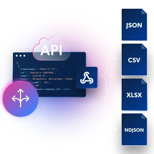
In what formats can I receive Geospatial data?
We deliver Geospatial data in the format that fits your workflow, including CSV, JSON, dashboards, or direct API integrations.
Can I receive Geospatial data on an ongoing basis?
Yes, Geospatial data can be delivered daily, weekly, monthly, or on any other custom schedule that fits your requirements.
Is Geospatial data compliant with privacy regulations?
Yes, we make sure all Geospatial data is collected in full alignment with website policies and global data regulations such as GDPR and CCPA.
What support will I have during my Geospatial data project?
You will have a dedicated project manager and full access to our specialists for ongoing consulting and support from kickoff to delivery.
How do I get started with Geospatial data?
Just click "Contact Sales" or submit an inquiry form. We will reach out to define your requirements and outline your Geospatial data solution.